Location
Wapanocca National Wildlife Refuge, Turrell. AR 72384
Interpretative Center open Monday – Friday 9:00 to 4:00
Office Phone: 870-343-2595
30.5 miles, 36 minutes from Benjamin Hooks Library, 3030 Poplar Ave. Memphis, TN
Paddling is best in in spring and early summer. Duckweeds, grasses and lilies make paddling a challenge later in the year. The refuge is closed to all other uses during an annual deer hunt in the fall and portions of the refuge are closed as a waterfowl sanctuary from December 1st through. February 28th.
From Memphis take I-55 North to Exit 21 (North of West Memphis) go East on HWY 42 through stop sign go under RR bridge 1/8 mile to Wapanocca entrance on right. Address: 178 Hammond Ave, Turrell, AR

Minimum/Maximum Levels for safe paddling
Controlled water level. Can be paddled at any time with the possible exception of extreme drought
Put-Ins, Take Outs
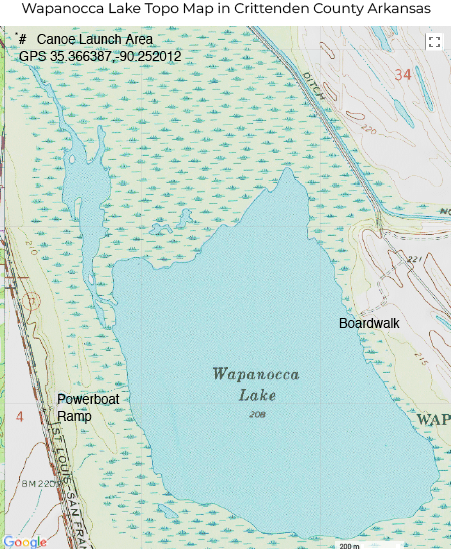
The canoe launch is over the bridge behind the Interpretive Center: GPS 35.366387, -90.252012. There is also a launch for fishing boats on trailers nearby.
Places to Stop, Camp and Services
None noted.
Highlights of the Paddle
There is a sizable stand of cypress to explore and lilies in the open areas.


Potential Danger Spots
None noted. Fishermen in power boats are often present but have not been a problem in the past.
Places to Camp In the Area
None noted.
Medical Facilities
None noted. Check with the office.