This page is under construction.
Location
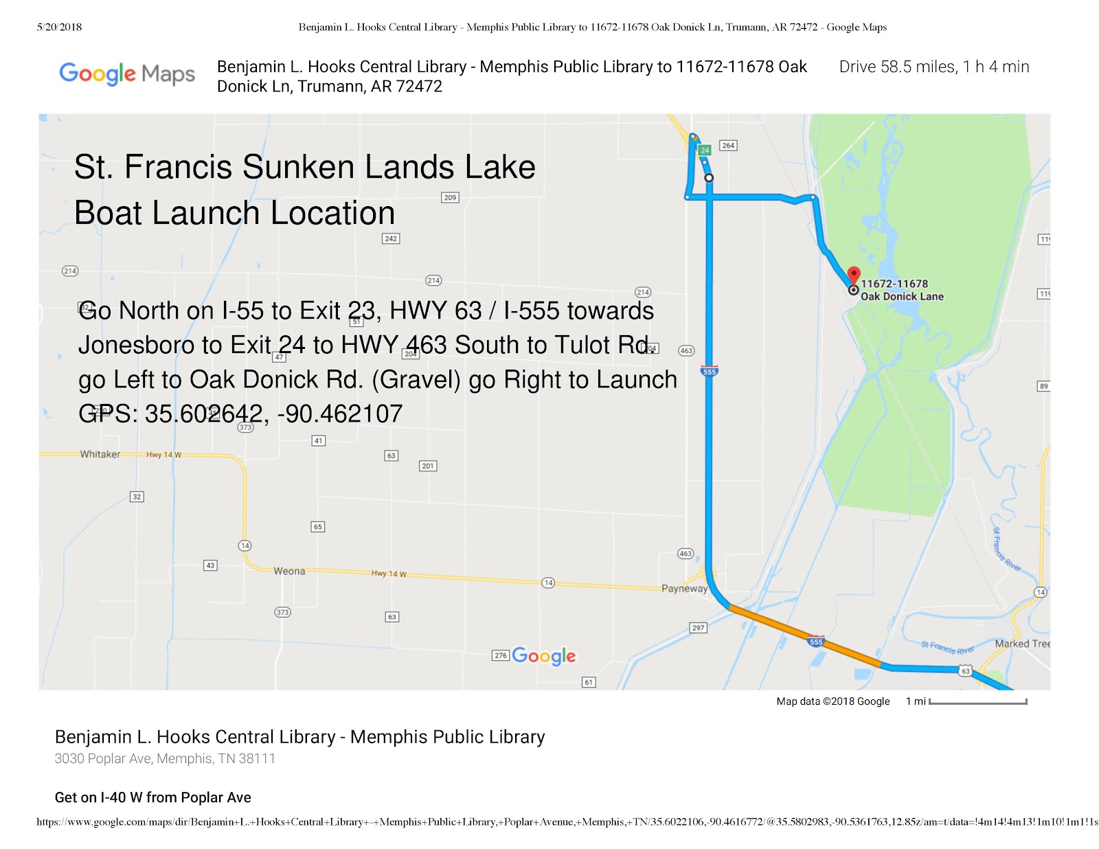
St. Francis Sunken Lands Lake between Marked Tree and Trumann, AR
58.5 miles, 1 hour 4 minutes from Benjamin Hooks Library, 3030 Poplar Ave. Memphis, TN
This is a large open cypress stand that goes for miles. The origin and characteristics of the area are similar to Reelfoot lake. However, it’s closer to Memphis and the cypress stands are more open to paddling. Some background information is here.
The St. Francis Sunken Lands WMA has been proposed for a scenic water trail. Maps can be found here. Please note that the map is incorrect for the head of the trail at Iron Bridge Access. When you launch, take a right down the ditch. You will see a chute to the left. Take the chute and then turn right to enter the river.
Minimum/Maximum Levels for safe paddling
Paddling experiences at stages between 10.26 ft and 16 ft on the Oak Donnick gauge have been fine. Minimum and maximum levels are not known at this time. Below 10.26 ft you might be bumping into a significant number of cypress knees.
Put-Ins, Take Outs

Places to Stop, Camp and Services
None noted.
Highlights of the Paddle
We paddle out the chute toward the main lake and cut through the cypress stand toward the north end of the lake. Here's an approximation on Google Maps satellite view.

Potential Danger Spots
Due to very strong currents, it is dangerous to paddle at the railroad trestle near the mouth of the lake. We have been told that a fishing boat with a moderately powerful outboard can barely make headway through this area. Our paddles always head north from the launch.

Medical Facilities
None noted for 24/7 emergency service. There are a couple of ambulance companies.
Phone numbers:
Trumann police dispatcher - 870-483-6423
Delta EMS - 870-483-6441